Ride Report: BRM200 Mariawald
The sticker on the French-Dutch-English trilingual card says "if you give up then notify this number." Thankfully, on my first brevet, I didn't need to make any phone calls. This post, as predictable as they come, shares my experience at this event last weekend and gives me another chance to show off GPX Replay and the new map style I designed to mimic cycle.travel.
what the Brevet?
Originally started more than a hundred years ago in Paris, the brevet is a long distance non-competitive self-supported cycling event. And you can tell they really mean it when the shortest version is 200 kilometers!
Just look at the route description; it's focused entirely on the beautiful scenery and places to stop and have cake or pea soup, as if cycling 10 hours in a day is the afterthought and the 8000 feet (2500 meters) of climbing doesn't even merit a mention. Somehow this nonchalant approach to extreme challenge is exactly what beckons to me. In a world that rewards the attention-seeking, I find it charming that this community is so dedicated to what they do while being completely understated.
I want my post here to capture a bit of this vintage-chill vibe. (Naturally that means I'm going to uphold the Randonneur spirit by delivering zero complaints about the rain, the endless climbs, the drivers imagining they were on the Autobahn, and the massive crosswind gusts that almost knocked me over on the descents.) (parentheses don't count)
Introduction
The preliminaries were easy to navigate. I signed up and paid the 10 euro entry on the web site, then downloaded the GPS file to my bike computer before the event. To be honest my biggest worry for the day was that I would be the only person there under the age of 55, since I imagined the target population would be retired men with a surplus of available time, high tolerance for sleep deprivation and a rather extreme interpretation of "self-supported" (no chatting!). That probably did describe some of the people participating, but thankfully there were several other people who were around my age.
If you're thinking about joining and this is your main fear as well, then I recommend going! Because if you don't then someone else may be left all alone. At the beginning you're handed a BRM card which you have to keep along. To prove that you actually completed the course, you need to collect proof at pre-designated checkpoints along the route. For example, you could take a photo of a town name sign, get a receipt from a store, or ask for a stamp from a hotel or restaurant. At the end of the day you hand in the card and it's signed by the club organizers who will later submit an official result to the bosses in Paris.
Since I arrived about 15 minutes early, after signing in I walked around and introduced myself while conducting a very discreet tire survey. Continental GP were certainly the crowd favorite, but a couple of others were riding Schwalbe Marathons too. Several of us were riding flat pedals and everyone else had drop bars.
With that long intro out of the way, the rest of the post will be structured by checkpoint.
Checkpoint 1: Obermaubach
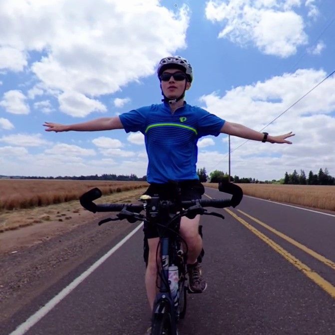
Everyone was in jovial spirits as we set off without much rush at 9am. A few people launched ahead quickly but most of the crowd of a dozen or so strung out along the paths before bunching up again at red lights in this section. This first part was also the flattest of the ride and the kilometers ticked by quickly. I was very content following the people in front, and when the route was quiet I chatted a little with Michael (GP5000) and Kossy (Marathon), whom I met at the start.
Before I knew it a small cluster of us rolled over a dam across a beautiful lake into the village of Obermaubach. The two people I rode in with each had a delicious-looking slice of apple pie surrounded by a moat of whipped cream. That seemed a bit too heavy for me so I opted for just a hot kaffee. While we sat there more and more people rolled in until we formed a veritable crowd of stamp-seeking water bottle refillers (we kept the proprietors quite busy!).
Checkpoint 2: Kall
Our group split apart soon after we left the first checkpoint, stretching out beneath the leafy trees along wonderful paths beside the Rur river (not to be confused with the Ruhr). Gradually the distances grew, and I found myself on my own; I knew there were people both ahead and behind me but I could no longer see them even when looking back from hilltops. Heimbach, video below, was a surprisingly picturesque little town. Later on we would even be coming back as the route plotted a figure 8 shape that intersected itself here.
Kall did not have much to see, notable on this day only for being the turnaround point at the far end of the route. Here I satisfied the control by holding my BRM card up to a Zentrum Kall sign and snapping a photo. Strictly speaking I probably could have made it the whole day with only the cake I had made the night before, but I decided to splurge a little and ordered the German classic, a döner kebab sandwich. Well, perhaps 6 euros isn't exactly peak extravagance, but it absolutely hit the spot! I had half of it, then wrapped the rest and carefully stuffed it in my bag and continued on.
Checkpoint 3: Eynatten
Immediately out of Kall the road ascended to the highest point of the day, where the Mariawald Abbey sat waiting atop the hill, tucked into a forest. Apparently it's known for pea soup, as the route description emphasizes several times. Without question, the weather was suited for savoring a warm bowl of soup, but since I was nurturing a döner belly, that didn't appeal to me at that time. Thus I pressed on after taking a couple of pictures.
Halfway down a breathtaking descent I had to stop for a one-way alternating signal. I took the chance to juggle my water around my bottles and double-checked the name of the next control point. Then, lo and behold, Michael materialized beside me. It was a welcome reprieve from the solitude that I was settling into. We caught up a little and continued onward together once the light flipped to green.
After a few hours of traveling across hills, forests, villages, hilltop villages, and forested hills, we said our temporary good byes once more as he took a food break outside a Lidl grocery store just short of the Belgian border. Eynatten, in the small German-speaking corner of Belgium, consisted of only a few houses. I'm not sure it would even qualify as a village. But it had a sign, and that's all I needed!
End: Snowworld (for the July snowsporters)
I took it easy for this final section, taking my time enjoying the views and making leisure stops halfway up climbs to let beetles cross the path. This part of the route meandered through the suburbs of Aachen, gaining distance while avoiding the Dutch border for as long as possible before finally giving in and crossing 4 kilometers from the finish. It was in one of these twisty sections outside the German city that Michael caught up again, and we completed the last hour of the adventure together, basking in the golden hour scenery.
Thank you for reading!
View Comments